Log in
All resources
Create a design
1,097,002 Free Images of Maps Of Ashtabula County
maps in the library of congress
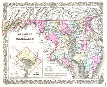
pennsylvania
ohio
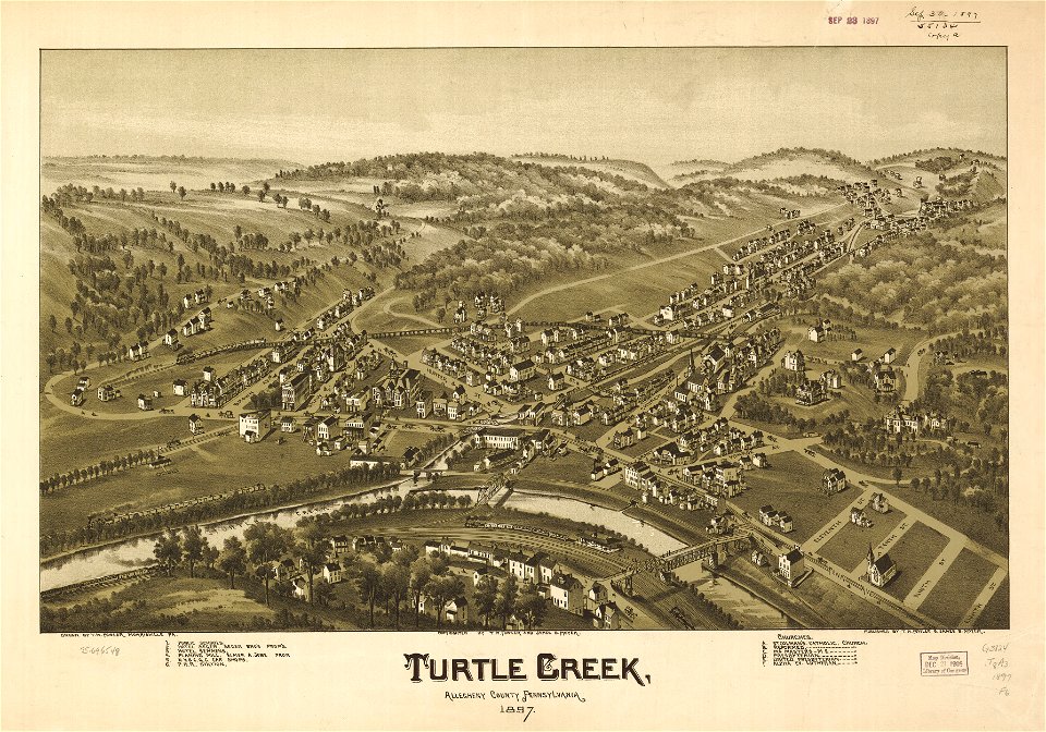
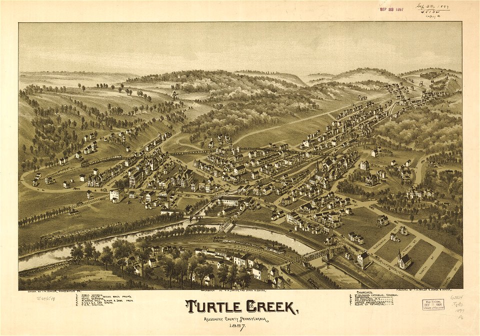
1897 maps of allegheny county
bird's eye view maps of ohio
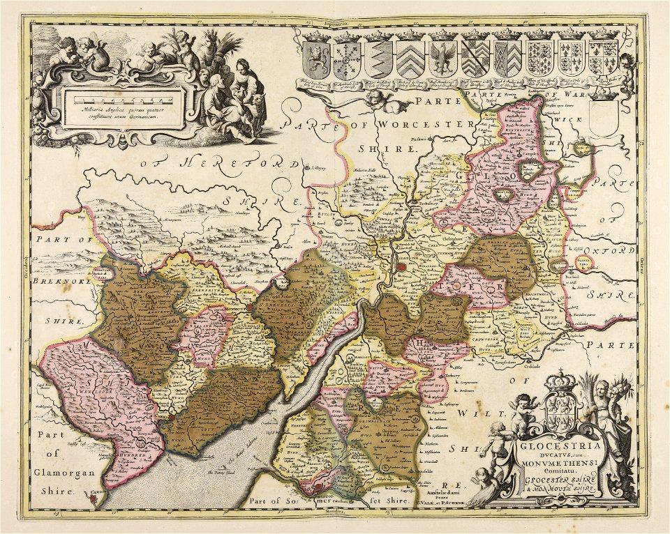
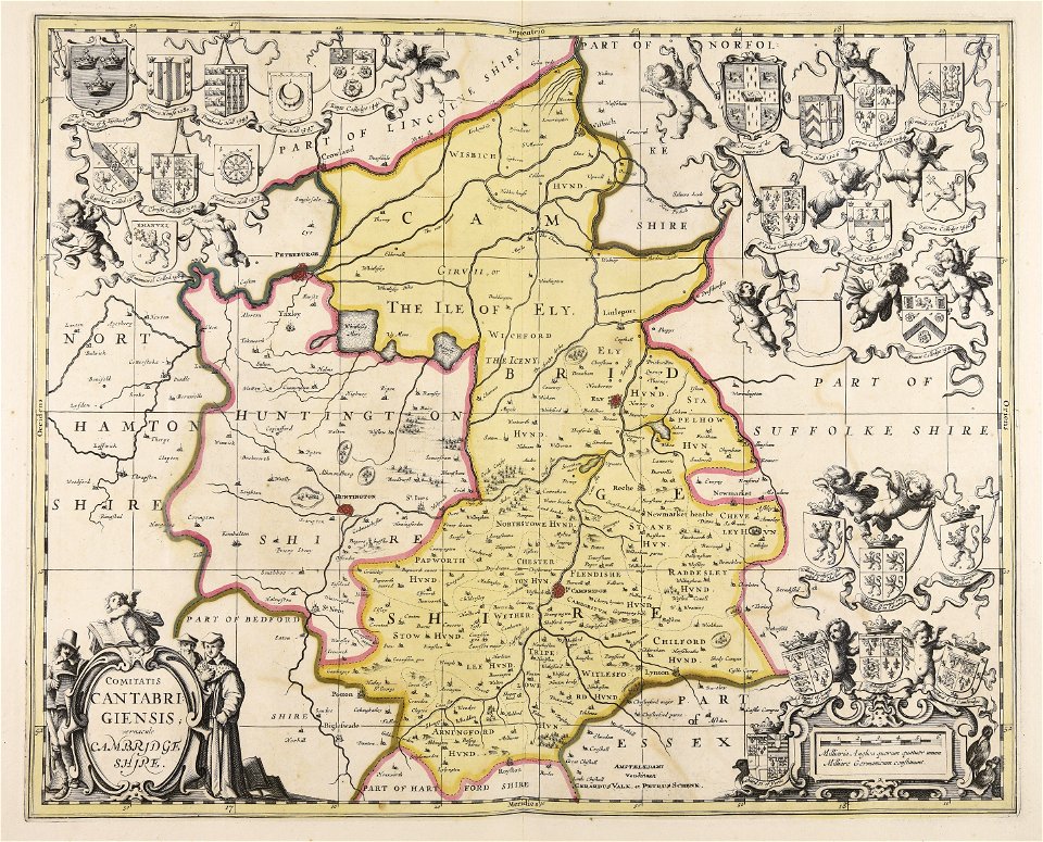
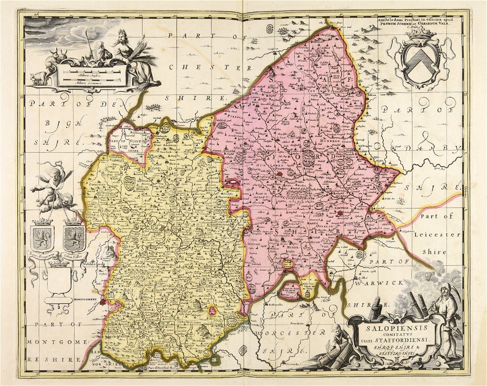
gerard valck
maps made in the 17th century
maps by pieter schenk (i)
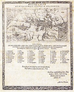
atlantis magni tomus secundus (biblioteca comunale di trento)
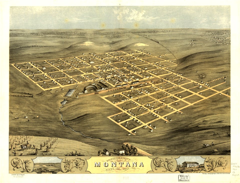
albert ruger
maps in the library of congress
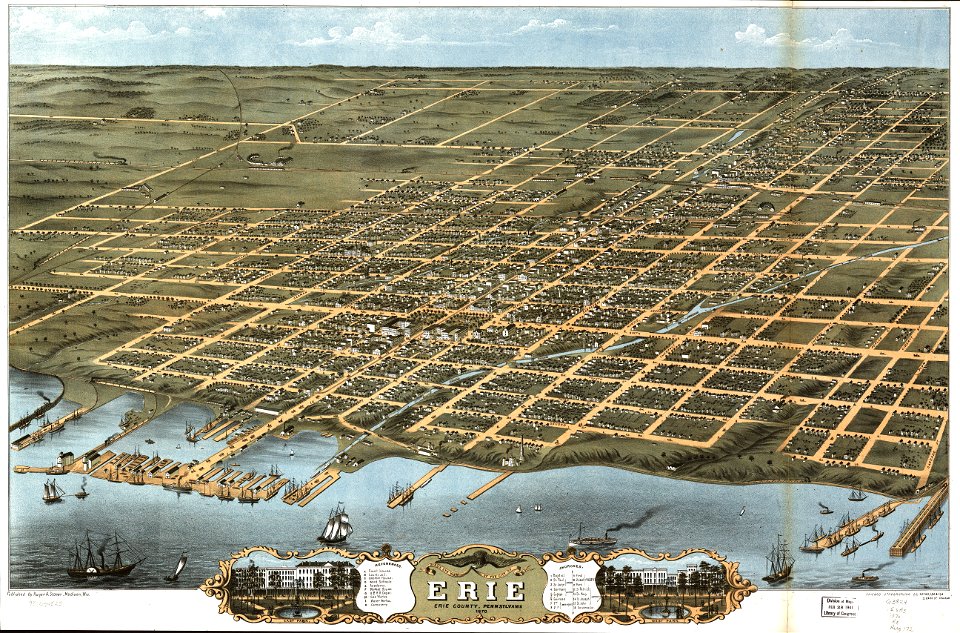
pennsylvania
maps in the library of congress
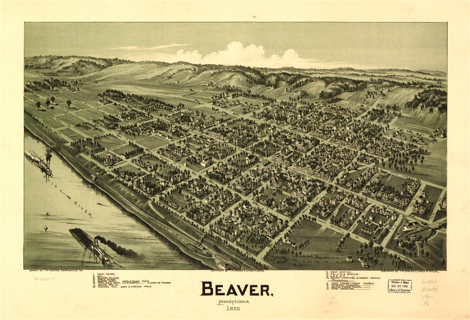
pennsylvania
maps in the library of congress
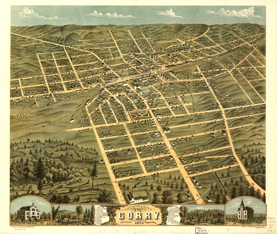
pennsylvania
maps in the library of congress
pennsylvania
maps in the library of congress
pennsylvania
maps in the library of congress
pennsylvania
maps in the library of congress
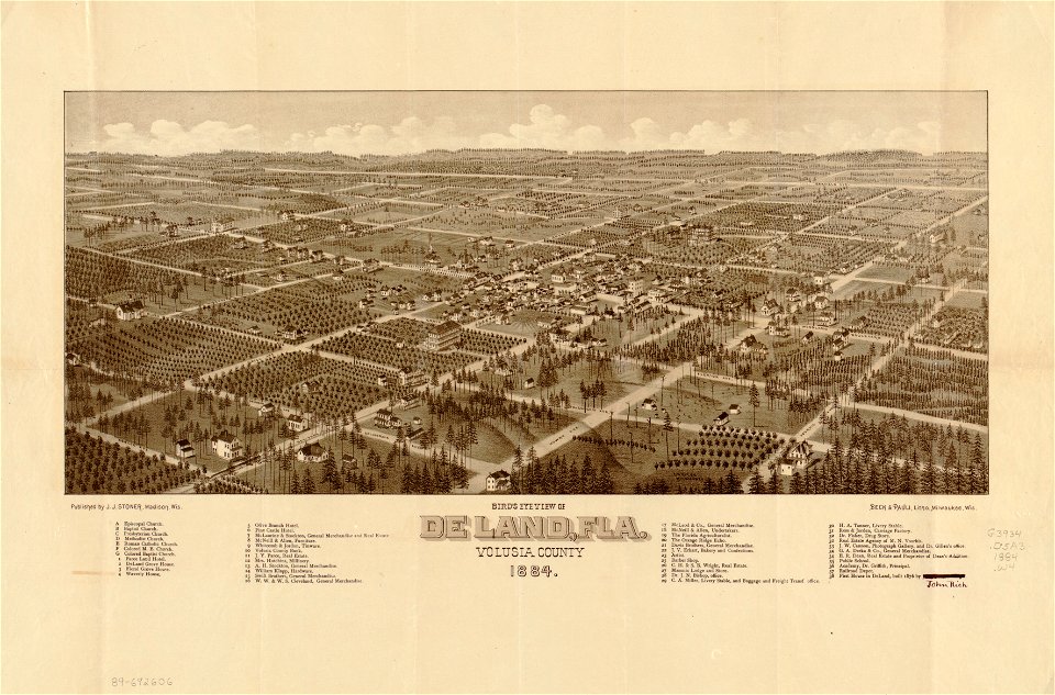
florida
maps in the library of congress
florida
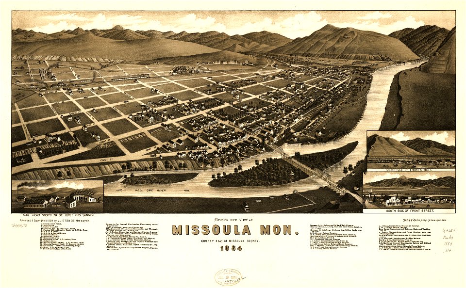
missoula
montana
missoula
montana
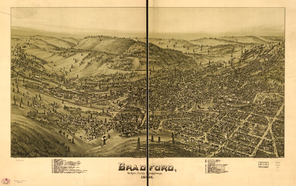
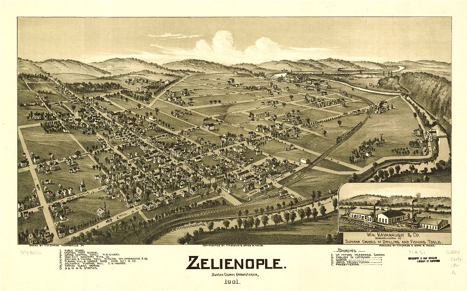
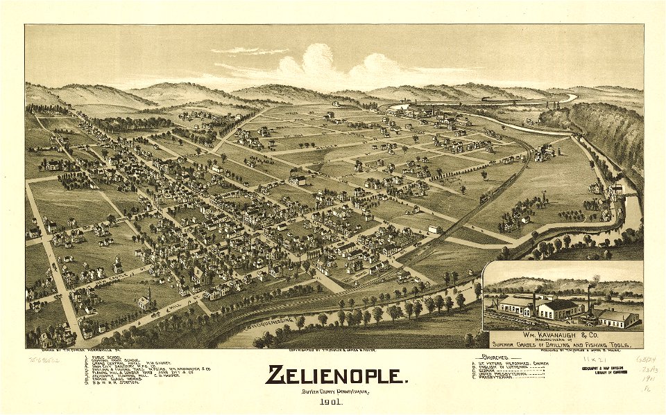
pennsylvania
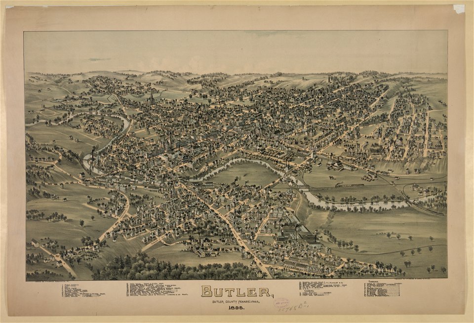
butler
maps in the library of congress
pennsylvania
maps in the library of congress
pennsylvania
1805 maps of the united states
maps by john cary
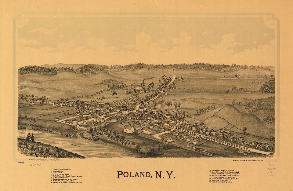
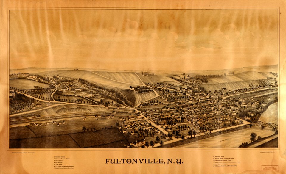
new york
poland
university of toronto wenceslas hollar digital collection
hollar maps and plans of london
kennebec river
maine
university of toronto wenceslas hollar digital collection
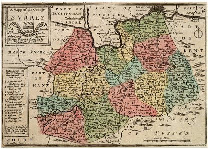
surrey
maps in the library of congress
washington
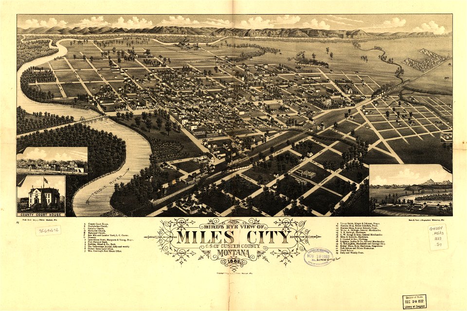
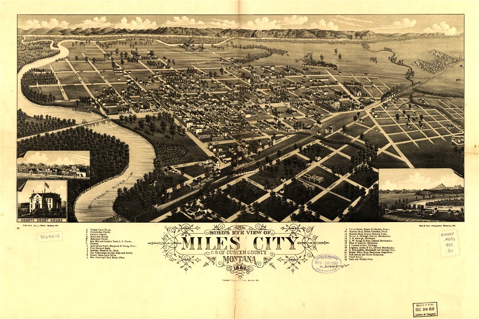
miles city
montana
maps in the library of congress
washington
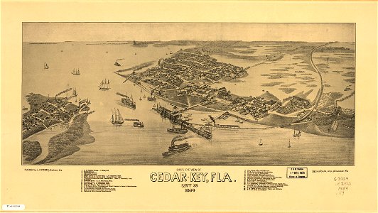
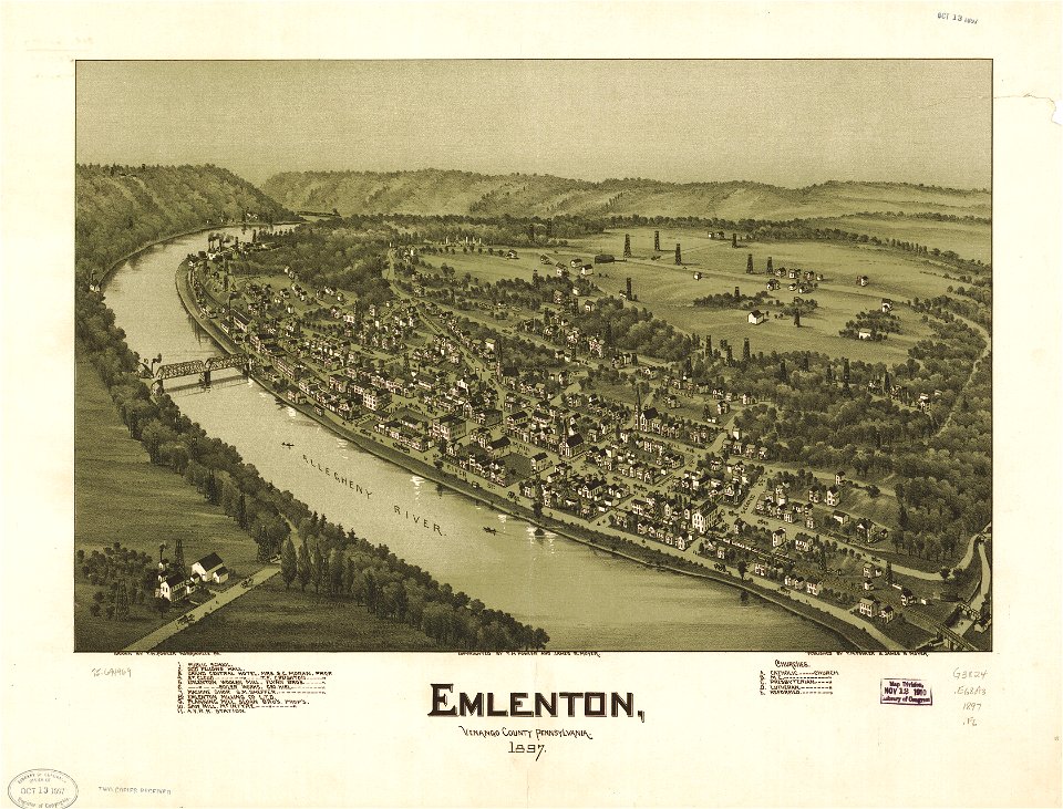
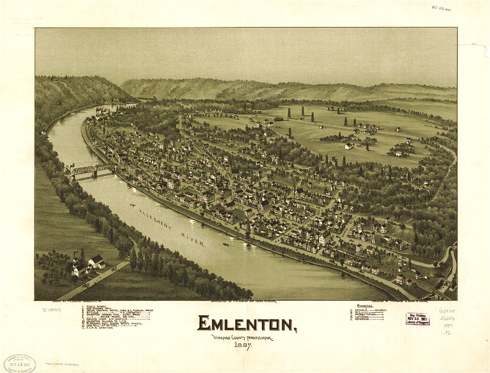
cedar key
florida
miles city
montana
cedar key
florida
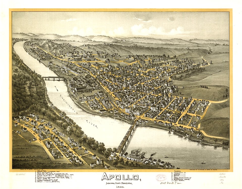
pennsylvania
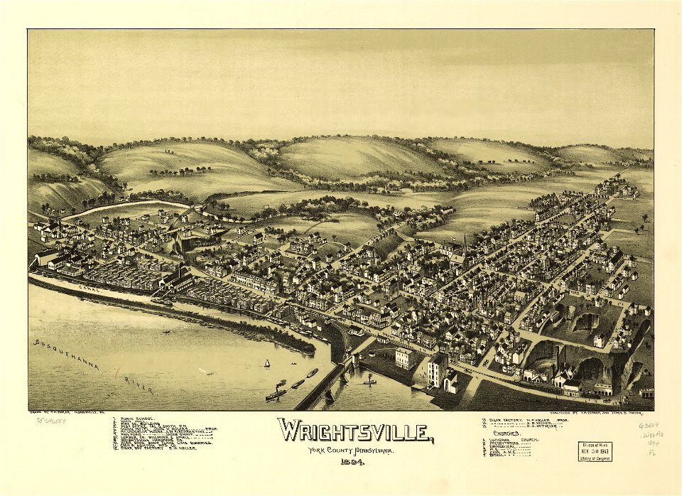
wrightsville
pennsylvania
wrightsville
maps in the library of congress
pennsylvania
maps in the library of congress
pennsylvania
maps in the library of congress
pennsylvania
maps in the library of congress
pennsylvania
maps in the library of congress
pennsylvania
pennsylvania
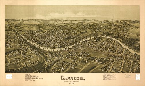
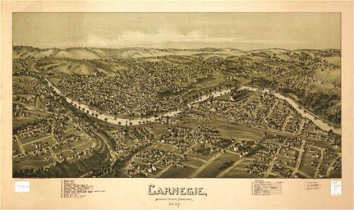
carnegie
pennsylvania
carnegie
pennsylvania
carnegie
pennsylvania
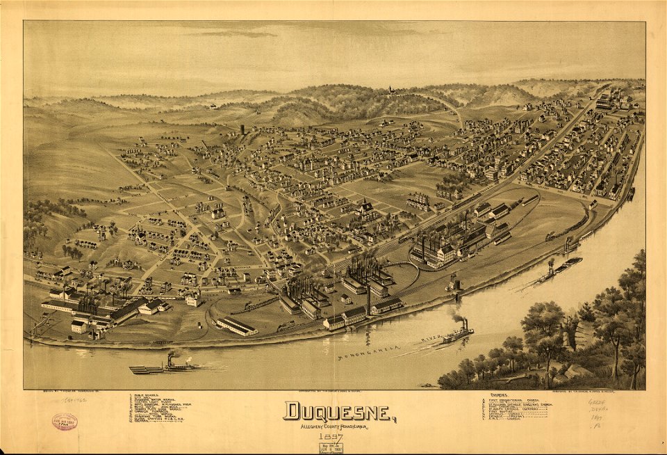
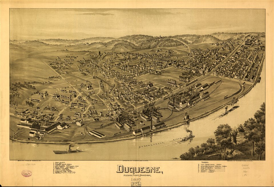
duquesne
pennsylvania
duquesne
pennsylvania
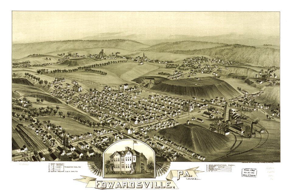
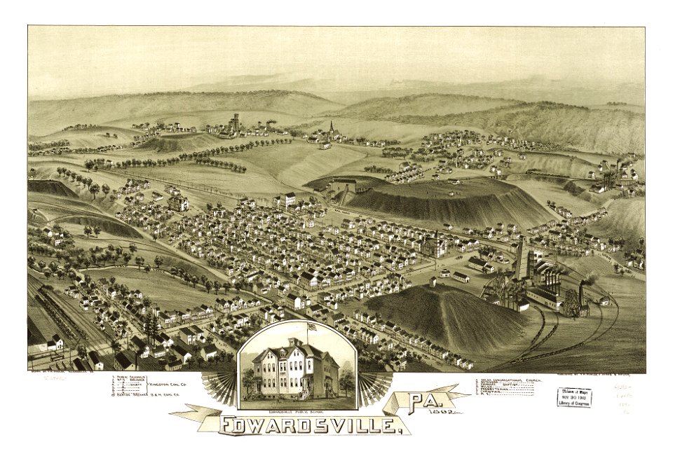
edwardsville
pennsylvania
edwardsville
maps in the library of congress
pennsylvania
maps in the library of congress
pennsylvania
pennsylvania
sheffield
pennsylvania
sheffield
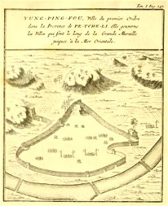
french-language maps of china
old maps of hebei
university of toronto wenceslas hollar digital collection
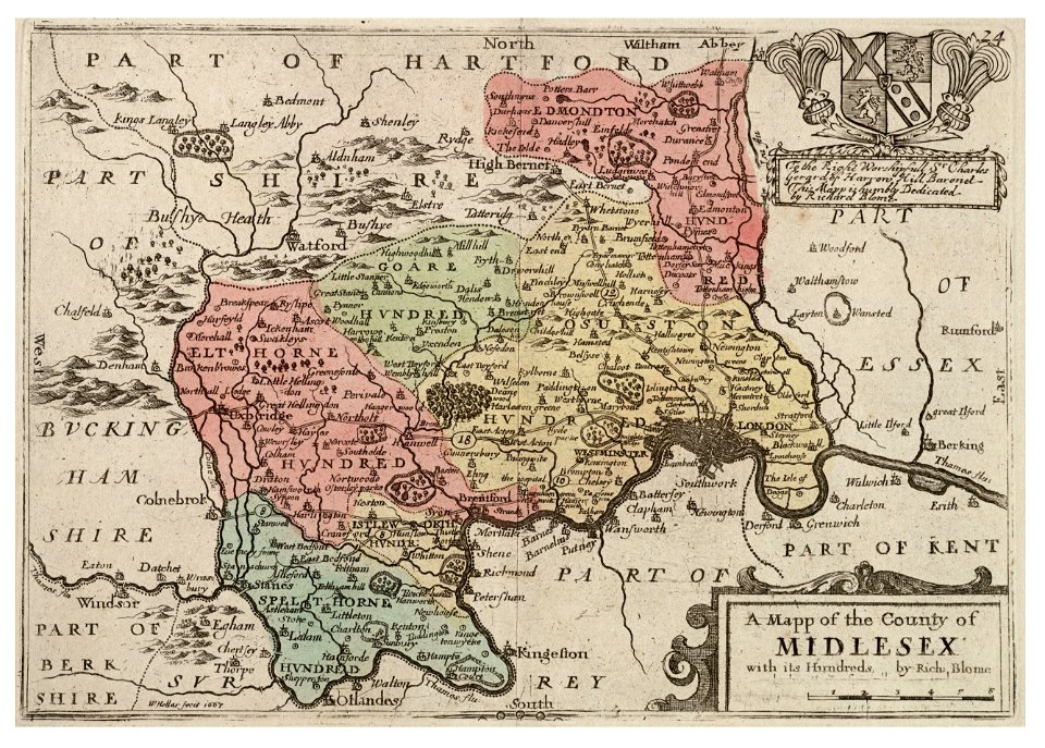
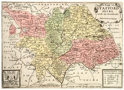
staffordshire
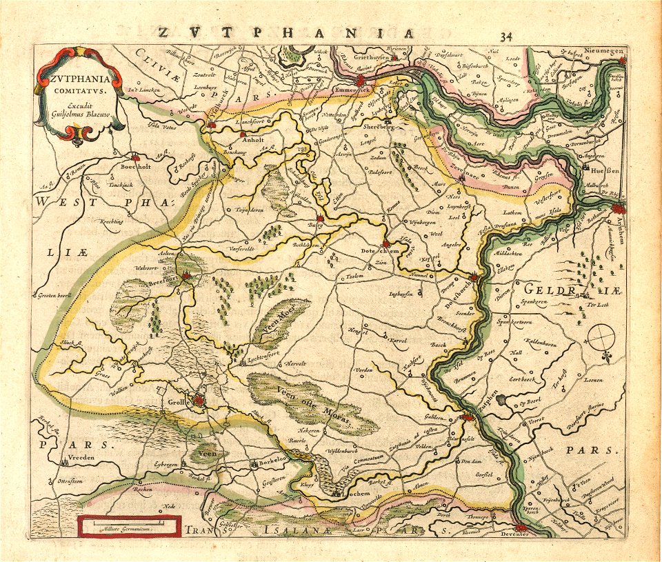
old maps of gelderland
old maps of zutphen
maps made in the 17th century
gerard valck
maps made in the 17th century
gerard valck
maps made in the 17th century
gerard valck
maps made in the 17th century
gerard valck
maps made in the 17th century
gerard valck
maps made in the 17th century
gerard valck
maps made in the 17th century
gerard valck
maps made in the 17th century
gerard valck
pennsylvania
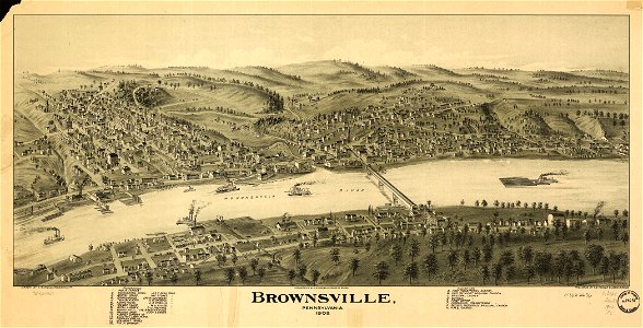
brownsville
pennsylvania
brownsville
1883 maps of south dakota
south dakota
maps in the library of congress
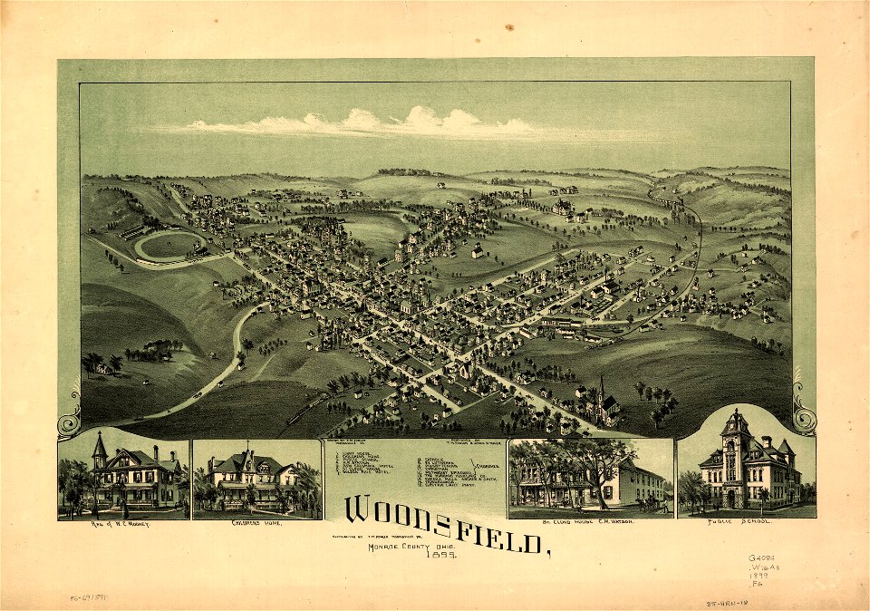
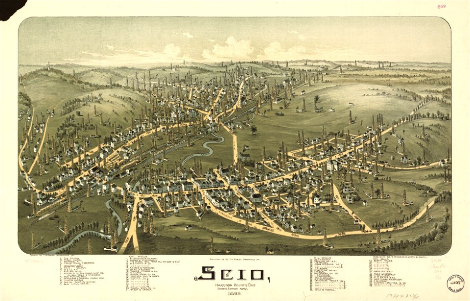
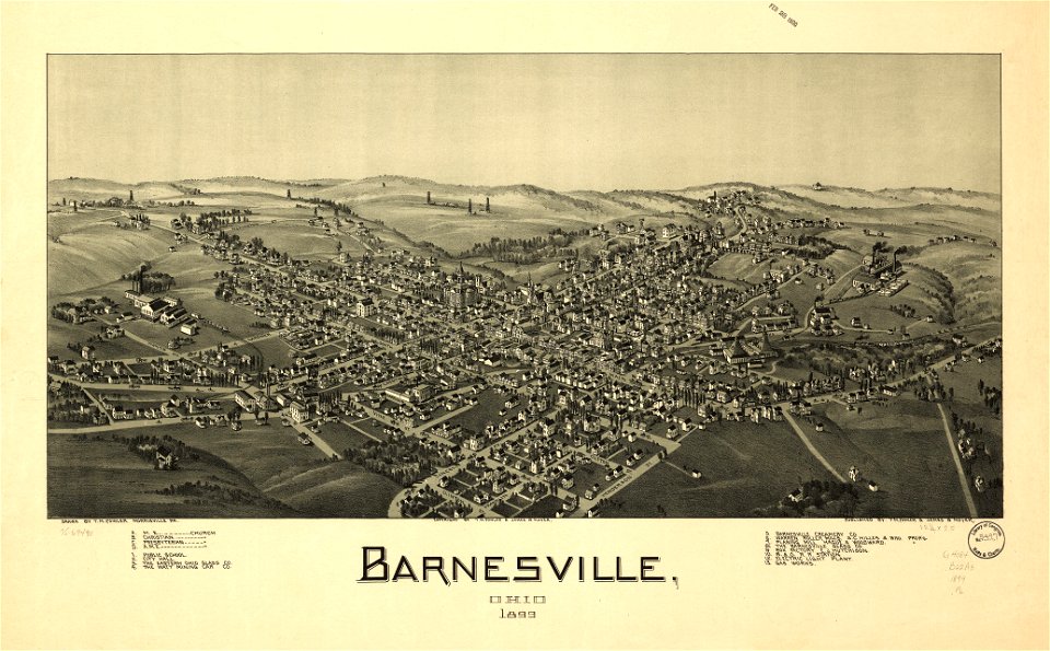
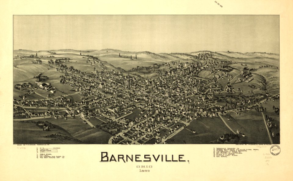
ohio
maps in the library of congress
ohio
maps in the library of congress
ohio
maps in the library of congress
ohio
19th-century paintings of battles
romanticism
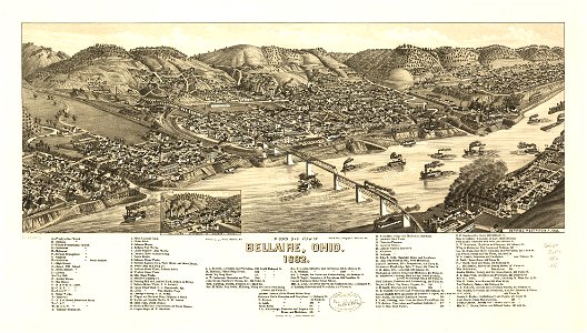
bellaire
ohio
bellaire
ohio
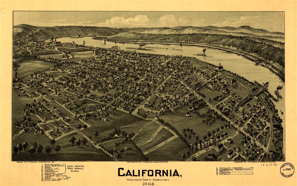
pennsylvania
california
maps in the library of congress
ohio
maps in the library of congress
ohio
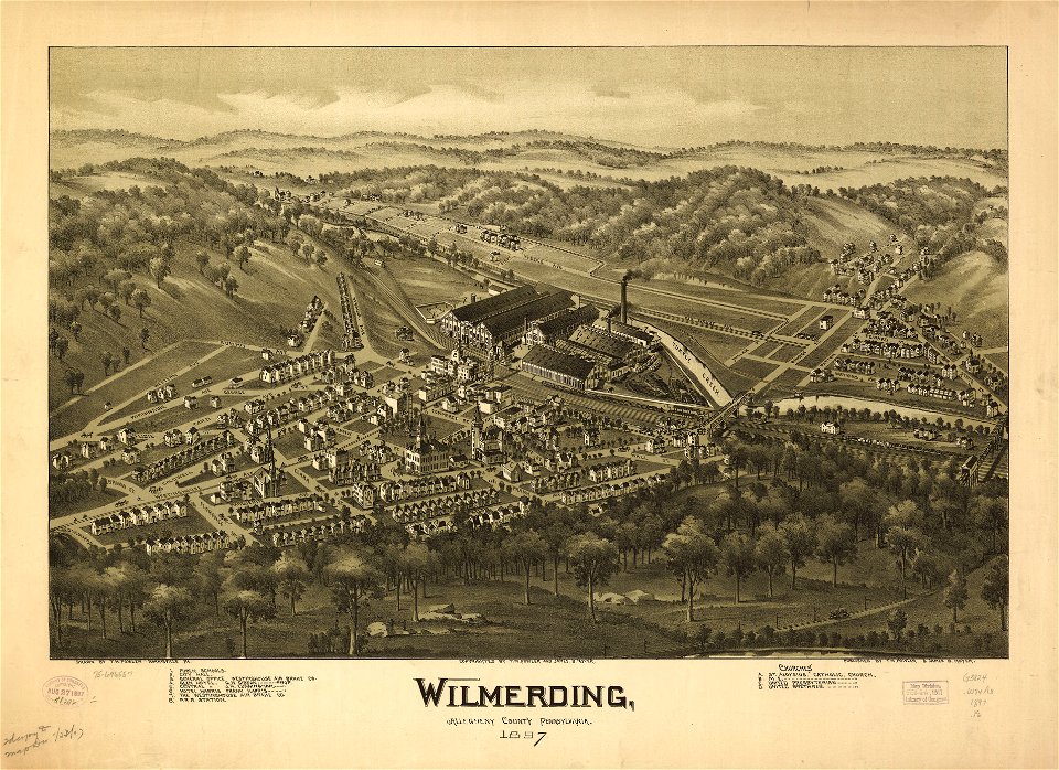
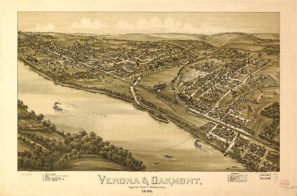
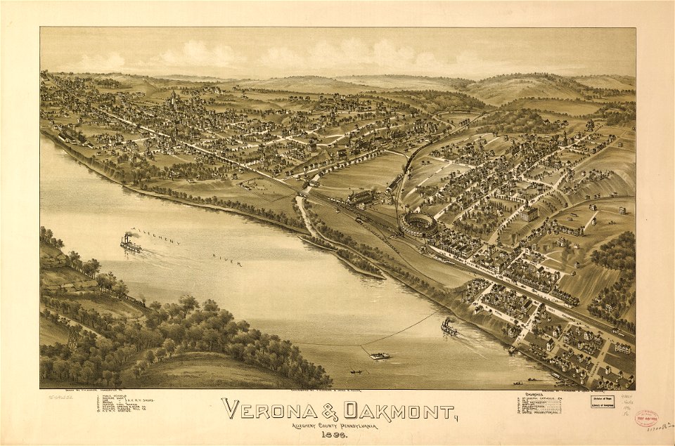
pennsylvania
verona
pennsylvania
verona
maps in the library of congress
pennsylvania
maps in the library of congress
pennsylvania
maps in the library of congress
pennsylvania
maps in the library of congress
pennsylvania
maps in the library of congress
pennsylvania
maps in the library of congress
pennsylvania
maps of oxia palus quadrangle
mars topography
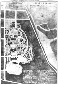
storer college
west virginia
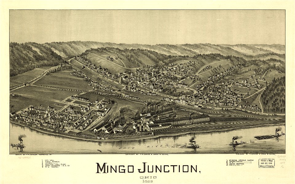
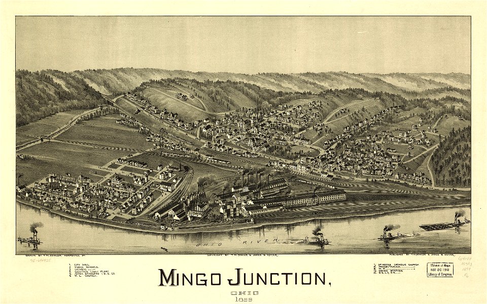
maps in the library of congress
ohio
maps in the library of congress
ohio
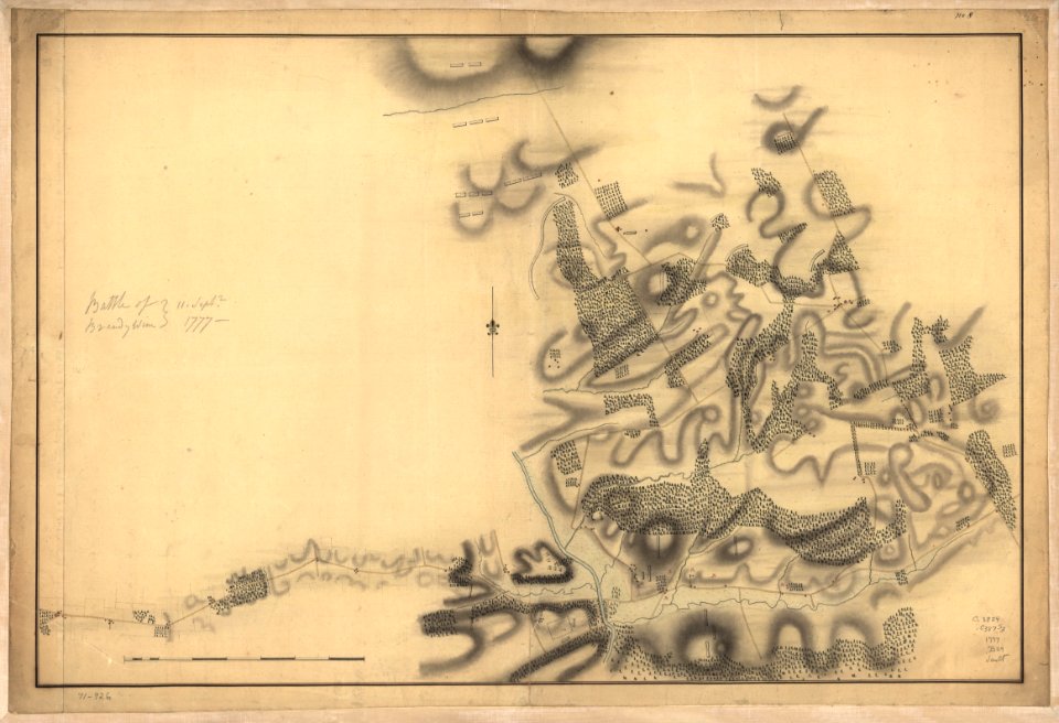
battle of brandywine
pennsylvania
battle of brandywine
pennsylvania
battle of brandywine
pennsylvania
battle of brandywine
pennsylvania
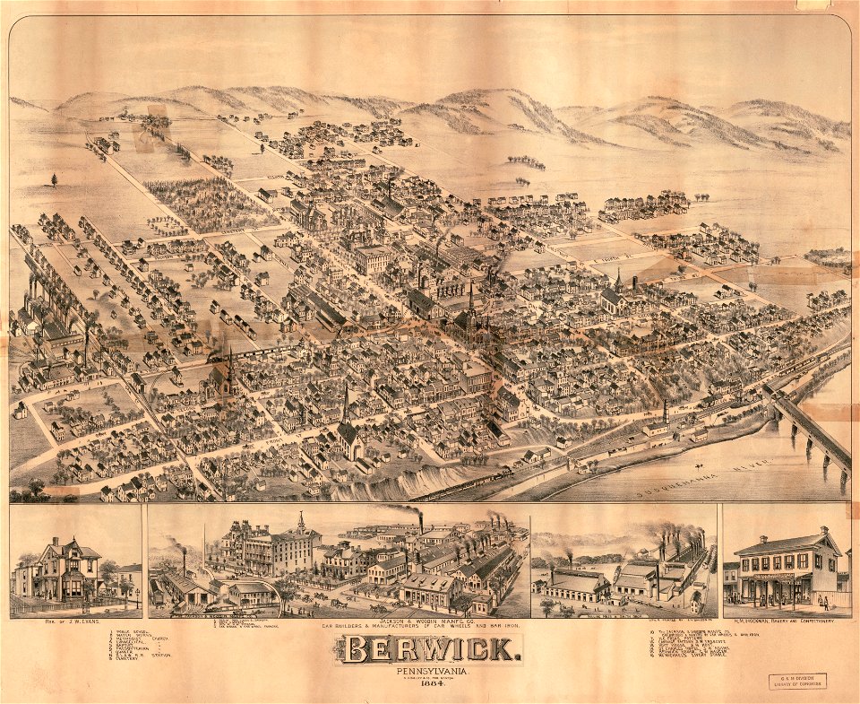
pennsylvania
berwick
pennsylvania
berwick
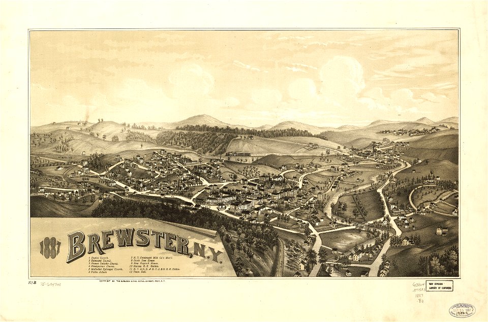
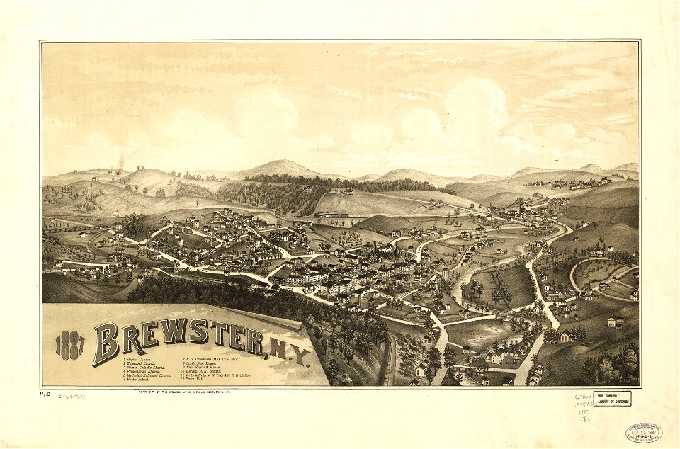
new york
brewster
new york
brewster
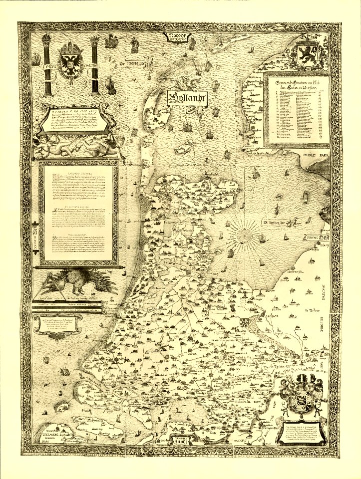
pillars of hercules in heraldry
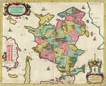
old maps of holland
maps in the library of congress
new york
maps in the library of congress
iowa
maps with cartouches
joan blaeu
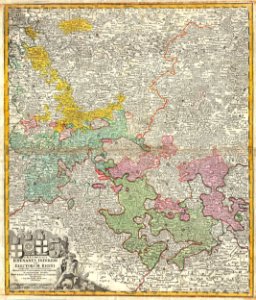
maps by homannsche erben
latin-language maps
university of toronto wenceslas hollar digital collection
old county maps of sussex
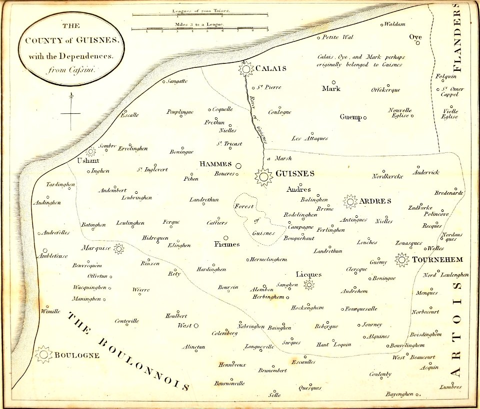
old maps of regions of france
baldwin iii
pennsylvania
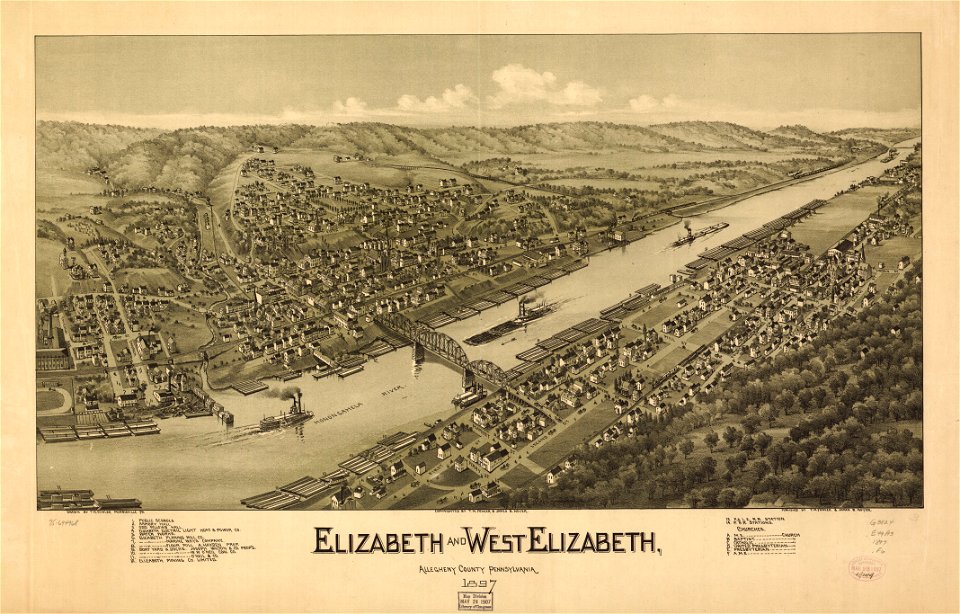
elizabeth
pennsylvania
elizabeth
stockholm
mälaren
virginia
d.c.,
indian territory
franklin pierce
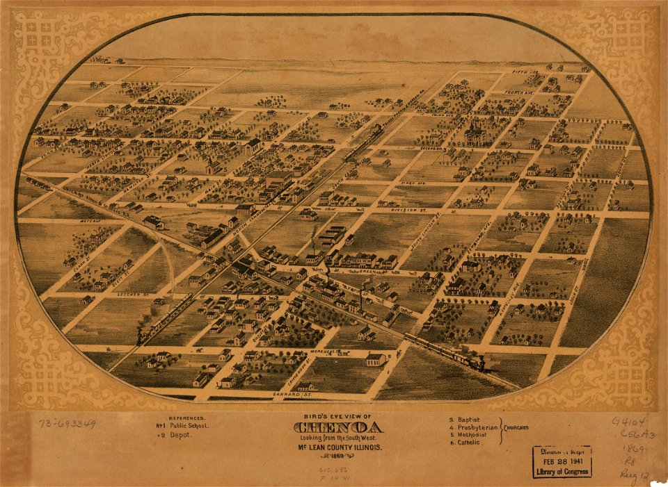
illinois
chenoa
illinois
chenoa
101 - 200 of 1,097,002
Next page
/ 10971